Castle Rock
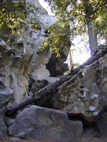
I crossed Highway 35 (looking very carefully for cars and motorcycles, which tend to travel way too fast around here, and entered the main entrance after 0.1 miles to Castle Rock State Park. (This would be a great starting point for the extended version of the Skyline-to-the-Sea Trail). I took the first singletrack to the left (South) as it climbed uphill for about 0.3 miles to the park's namesake, Castle Rock. Castle Rock is a big sandstone rock that is very interesting to see, and very popular with rock climbers. There are also a number of smaller sandstone rocks around.
After admiring the strange rock, I continued on the trail as it wound around and behind Castle Rock, and then descended for about 0.5 miles through the trees into a small gully and the intersection with Saratoga Gap Trail. I then headed left (West/downhil) on Saratoga Gap Trail as it descended for another 0.3 miles or so to another split.
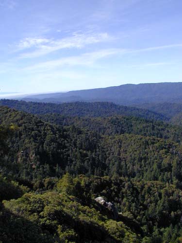
(The trail heading uphill to the right at this point is Goat Rock Trail, and, if you have the time, is a very worthwhile side-trip of about 0.5 miles each way (with a lot of rocky climbing on the way out) to Goat Rock. Goat Rock, like Castle Rock, is very popular with rock climbers, but has the advantage that you can also take the stairs (and a short scramble climb) to the top with no gear for an outstanding view to the South of the Santa Cruz Mountains. On a clear day, you can see all the way to Santa Cruz and the Monterey Bay.)
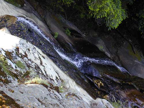
I was short on time, so I headed downhill on Saratoga Gap Trail for another 0.2 miles to a wood observation deck overlooking the mountains and the (very tall) Castle Rock Falls. The falls are tall, but not a lot of volume is flowing over them, and it's difficult to get a great view from the top of the deck, since you are looking directly down on the falls. Just don't fall off the platform trying to get a good look!
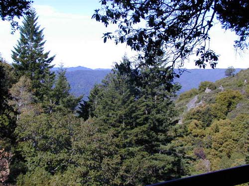
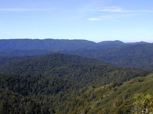
After leaving the observation deck, the trail gets even more interesting as it climbs down and around the side of the mountain. The trail dodges in and out of trails for a while, but soon emerges into scrub brush with occasional breaks providing great views of the valley. The trail also gets pretty rocky and challenging in this section.
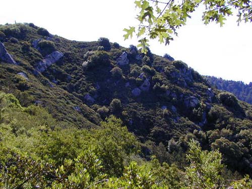
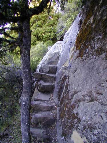
I followed the signs toward the Castle Rock Trail Camp, and as I got near the camp, I was really excited about a short section of trail where some steps are carved out of the rock, and you have only a steel cable that is attached to the rock wall to hold you on the trail.
2.2 fantastic miles (and one short climb at the end) from Castle Rock Falls, I found myself entering Castle Rock Trail Camp. The camp is situated on top of a small ridge, and offers some nice campsites (reservations required!). This is also where the park headquarters is located. After you stroll through the campground, you have a choice: you can continue North on Saratoga Gap Trail (now a fire road) or you can head NorthEast on (singletrack) Loughry Woods Trail.
There are several signs posted by the park stating that hikers are "encouraged" to take Loughry Woods Trail to Skyline Trail. I figured the scenery on Saratoga Gap Trail (judging by what I'd seen so far) would be better, and different, so I chose to go that route. If I had it to do again though (or if I was hiking the Skyline-to-the-Sea Trail), I would recommend following the park's advice and taking Loughry Woods Trail for about 1.5 slowly ascending miles through the trees to Highway 35, and then another 1.4 miles or so on Skyline Trail to Saratoga Gap. This would also give you the option of a short side-trip to Summit Rock if you had the time. (The map I have says this route is 3.7 miles, but I'm not sure how...)
Anyway, I instead headed North, and downhill, on Saratoga Gap Trail, which was now a wide fire road. The trail descended steeply for about 0.5 mile to a small canyon, and then began climbing up the other side (and out into the open, again with some nice views) for another 1.7 miles or so. The trail then turns into a paved road (and I believe changes name to Saratoga Toll Road). At this point, there are signs stating that passage is granted by the private owners, and you must fill out a permit to proceed. However, there were no permits in the box when I was there, so I went ahead sans permit. The "trail" at this point is really just an access road (a.k.a. driveway) for a number of houses, and people drive way too fast on it. I found myself hugging the shoulder and wondering how I would dive out of the way of a speeding car without falling down the side of the hill.
After about 1.2 miles of this, I finally reached another singletrack splitting off to the left (and another "permits required" sign for hikers heading the other direction). Back on the real Saratoga Gap Trail now, I headed another 0.5 miles or so along the trail as it first descended and then climbed up to the intersection with Skyline-to-the-Sea Trail/Saratoga Toll Road Trail. If you were doing the Skyline-to-the-Sea Trail, you would head left (West) here down the trail toward Waterman Gap Trail Camp, about 5.9 miles distant (but almost all downhill...see Waterman Gap/Saratoga Gap Loop (Skyline-to-the-Sea Trail Section 1) for more info...).
Since I was ending my loop, I headed to the right for a few tenths of a mile up to Highway 9, and then followed the Highway for a short distance, and then across Highway 35, back to the parking area.
| Back | Skyline/Castle Rock Loop |
| webmaster@muddybike.com | South Bay Hikes | Copyright © 2002 Kevin Sage |