
This ain't the road, mister...
About 0.5 miles from Saratoga Gap, I came to an unsigned trail junction where a singletrack split off to the right steeply uphill. Since it was unsigned, I wasn't too sure this was the right trail, but I figured it went up toward the highway, so I might as well give it a shot. I headed up the trail and soon found myself on the Southern shoulder of Highway 9. Across the road, I could see another singletrack trail disappearing into the trees. I carefully crossed the highway, and started down the trail, which dropped quickly about 10 or 20 feet downhill. As soon as I had dropped to where the trail flattened, there was a nice big sign announcing that this was, indeed the Skyline-to-the-Sea trail. Ahh, signs...this was more like it!
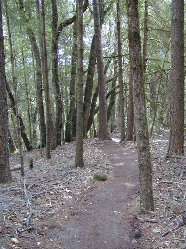
The trail followed right next to the highway for some time, traveling just far enough below it that you couldn't see it, but close enough that you always heard cars and motorcycles going by. The trail was easy, as it was smooth singletrack that constantly dropped at a steady grade. I passed a group of people with packs... why anyone would backpack the Skyline-to-the-Sea in the wrong direction is a mystery to me, since that means you basically climb the whole time, but then again most people wouldn't be trying to hike the trail as a series of day hikes as I was either.
Apparently, the reason the trail is so close to the road most of the time is that when the highway was built, the state had a right of way for the road that was quite a bit wider than the road ended up being. When it came time to build the trail, the easiest place to put it was on that right of way because there were then no land battles. Amazingly, as close to the road as the trail is, it's surprisingly pretty, offerring lots of pine tree forest and the occasional view NorthWest into a large valley.
After dropping for some time, the trail emerged onto a dirt road near a Boy Scout camp. I followed the road for a short distance, and then (following the now-plentiful signs), I recrossed Highway 9 at a Vista Point, (Sempervirens Point).
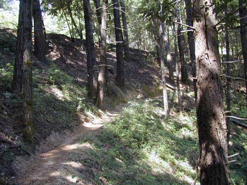
After stopping to admire the view for a minute, I continued to the SouthWest on the trail, which plunged back into the forest and headed away from the highway for the first time since leaving Saratoga Gap. The trail dropped fairly steeply for a while, and then leveled out a bit as it again came near the highway. The trees were really cool, and I found myself really liking the trail.
I soon began hearing gunshots, and realized with dismay that what I was hearing was the Los Altos Rod and Gun Club's shooting range, which was actually quite a ways away on Highway 35 near Castle Rock State Park's main entrance. Although I knew I was in no danger, gunfire is nevertheless a disturbing thing to hear when you're hiking, and at the very least it ruins the nature experience. Every time I hike in the area, I am annoyed by the noise. Why anyone would build a shooting range in the middle of hiking trails is beyond me...
Anyway, enough ranting... The trail continued to drop on a pretty steady grade, with more nice scenery along the way.
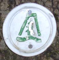
2.9 miles or so since I had split off of the fire road to climb up the first highway crossing, I met back up with Beekhuis Road Trail. The trail was more clearly signed in this direction, and if there was any doubt about which trail was the Skyline-to-the-Sea, there were now nice (although small) blazes on the trees.
0.2 miles later I reached the junction with Cut-Off Trail, which had previously confused me. However, in this direction when you're simply staying on the Skyline-to-the-Sea Trail, it's not confusing at all...you just keep going straight.
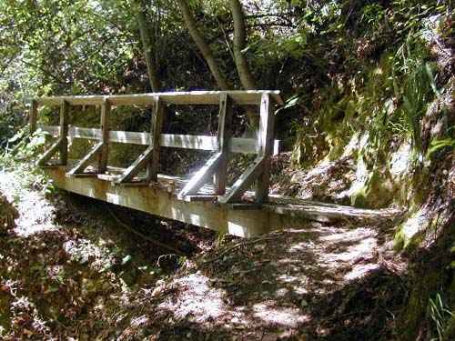
From here, I retraced my steps another 2.3 miles (which contained some uphills I didn't remember) to the Waterman Gap trail camp. Along the way, I took a picture of a bridge, which for some reason I thought was a really cool bridge.
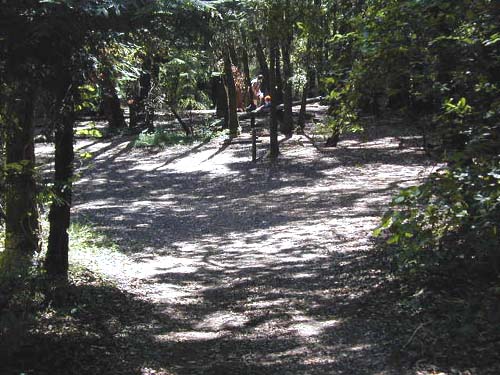
When I got back to the trail camp, there were no longer any hikers camped out, although there was one family who had apparently hiked in from the road for a picnic or something. I took a quick picture of the campground just in case I ever needed it.
I was getting tired at this point from all the constant downhill, but I managed to drag my tired self the last 0.4 miles back to my car at the Highway 9/Highway 236 junction, for a total of 13 miles. To my surprise, it was still pretty early (about 11:40). Not a bad way to spend a morning!
| Back | Waterman Gap/Saratoga Gap Loop |
| webmaster@muddybike.com | South Bay Hikes | Copyright © 2002 Kevin Sage |