Trailhead for the Skyline-to-the-Sea Trail
The singletrack trail climbed a bit up and over a (very small) ridge, rising through some very nice, heavy pine trees. The trail quickly began going back downhill/flat, and after only 0.4 miles, I reached the Waterman Gap trail camp. I quickly scanned the campground to see what it looked like, noticed a few sites, a pit toilet, and a couple tents scattered about, and then moved on. It was still early (about 7:40) and most of the campers appeared to still be sleeping.
Although the camp is actually behind a hill from Highway 9, and is therefore relatively quiet, after leaving the camp the trail moves back over near the highway, and stays quite close to it the rest of the way. The trail was predominantly singletrack through forest, but occasionally would turn into short stretches of fire road, and sometimes exit the heavy forest and enter more grassy terrain. It was evident I was near the highway from the various cars littering the West side of the trail.
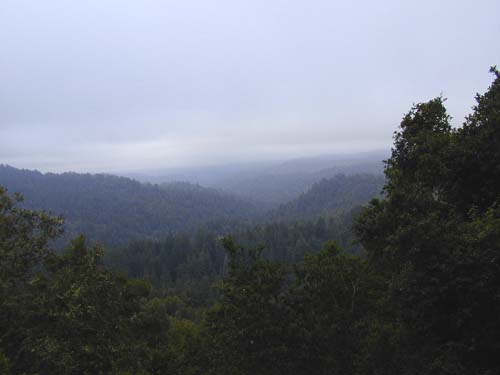
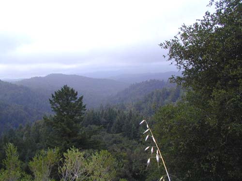
Occasionally, the view would open up to display a great view of the valley to the South. The fog, however, did not provide for long-distance visibility.
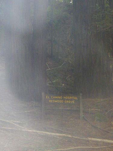
After climbing for a while, I stopped in a nice redwood grove to relieve myself. As I was doing so, I noticed the name of the grove, "El Camino Hospital Redwood Grove". I thought it was pretty funny to find such a thing, because my wife had worked at that hospital before I'd met her.
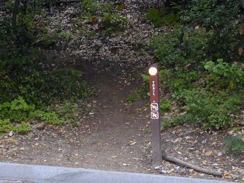
I continued climbing, and noted that the sun was finally starting to make an appearance. About 2.3 miles from the campground, as the trail turned into a recently bulldozed doubletrack (I guess that's what I'd call it), I reached an interesting trail junction.
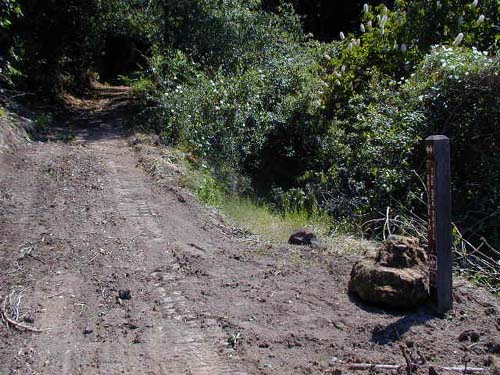
I was a bit puzzled at this point... I had seen a map online that had shown a short trail called "Cut-Off" that was supposed to head East from the Skyline-to-the-Sea Trail over to Beekhuis Road Trail, and eventually down to Saratoga Toll Road Trail. However, my map, irritatingly, did not show it. My map also did not list any distances, so I was left to use my thumb on the scale and kind of guess at how far things were supposed to be. I thought this trail might be the Cut-Off I was looking for, but alas, the sign, in it's oh-so informative way, told me simply that whether I went North or South, I was on the Skyline-to-the-Sea Trail. Which was good to know, but I already knew that...losing the trail was pretty tough if you just kept walking straight ahead.
I was doubly perplexed here because I had already gone off-trail quite a ways once on a dirt road that I thought might have been the Cut-Off trail, but it instead turned out to drop quite quickly to a lumber company, and I'd had to retrace my steps. At least here it looked like a real trail, but with no signs, I wasn't sure what to do. I finally decided to gamble and see where it went, as it looked reasonably flat. Fortunately, it was indeed the right trail; after 0.2 miles, as I re-entered the forest, the trail merged with Beehuis Road Trail, and of course, at this end, there was a sign naming the trail as the Cut-Off Trail. (By the way, in the picture above, you would go to the right to get onto the Cut-Off Trail).
Now that I knew where I was, I headed downhill on Beekhuis Road Trail, noting that I had not yet seen anybody on the trail except for the few groggy hikers waking up at the trail camp. It was odd, but very cool. Anyway, Beekhuis dropped for about 0.2 miles before emerging at a broad, open intersection with Saratoga Toll Road Trail (known on many of the signs, I might add, simply as "Toll Road Trail").
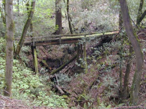
I turned left and headed North on Toll Road Trail as it started climbing again. The Toll Road trail basically parallels the Skyline-to-the-Sea Trail at a generally slightly lower elevation, and farther from the highway. I figured it'd be a nice way to make a loop. I quickly reached a split in the trail where the trail turned into more of a singletrack/doubletrack splitting off to the left. I thought the bridge (which said "No Trespassing") looked neat.
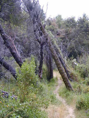
After some more quick, but well graded, climbing, the trail flattened a bit as it wound it's way through some interesting open terrain, and through some very strange looking trees.
Just after passing through the above stand of trees, 0.9 miles since getting onto Toll Road Trail, the trail re-entered the forest, and in a few short yards, I came to yet another perplexing trail junction... The split was basically a "Y", with one split heading slightly uphill to the left on what looked to be a really old fire road, and the other split heading slightly downhill on singletrack to the right. In the middle of the two trails was a signpost, with a single arrow pointing directly between the trails! Guessing that at least one of the four sides of the signpost had to be more useful, I walked around it... From the left-hand trail, looking down hill toward where I'd just come from, the sign said simply "Trail" and had an arrow pointing to the left, which I assumed meant to the other fork. From the right-hand trail, looking back toward where I'd come from, there were double-headed arrows pointing left and right. So what I knew was that all three directions were trails, which of course made me feel immeasurably better...
I guessed from what I remembered seeing on my map that the left-hand split, which headed uphill, must be the right one. I later figured out that the right-hand split was the Travertine Springs Trail, which did not go anywhere near where I wanted to go. Luckily, I had guessed right.
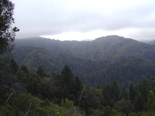
The trail, now fireroad/doubletrack all the way to Saratoga Gap, then climbed uneventfully for about 2.4 miles. Along the way I was afforded some great views.
After 2.4 miles, I finally emerged onto another wide trail, the Skyline-to-the-Sea Trail. About 0.5 miles further uphill was the actual gap and trailhead, and I walked up there just to prove to myself that I was where I thought I was. About 0.1 miles from the trailhead, another singletrack also headed downhill to the South over toward the Saratoga Gap Trail. I took the opportunity to have lunch (a granola bar) at this spot and saw my first people of the day while I was sitting there. It was still early, I was feeling good, and I knew my climbing was over...6.7 miles down...
| Waterman Gap/Saratoga Gap Loop | Next |
| webmaster@muddybike.com | South Bay Hikes | Copyright © 2002 Kevin Sage |